
MAPPING
DGPS, Terrestrial Scanning, Remote Sensing & GIS-based mapping systems are the key emphasis of the OSMANI Mapping division. Specialty expertise is offered by us in sub-centimeter level surveys, mapping & GIS of large Greenfield & Urban projects from 1,000 acres onwards with specialist teams of surveyors & mapping professionals.
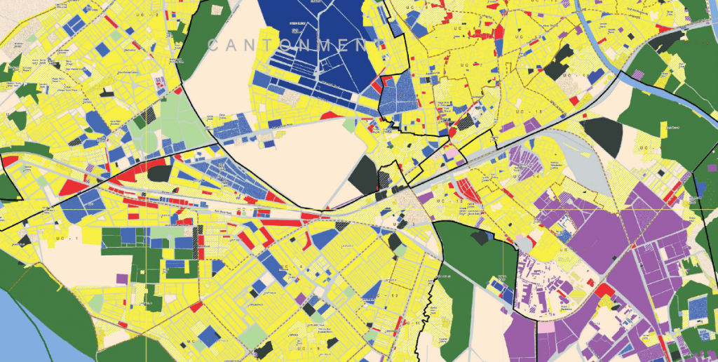
GIS & RS


- Hyderabad Geographical Info System
Plot level GIS with Education & Health layers PD Hyderabad District Action Plan Hyderabad - SSGC Geographical Info System
Base GIS for Gas Dist. & Trans. Network Sui Southern Gas Company Ltd. (SSGC) 50+ Cities of Sindh Province K4 Bulk Water Supply
10,000 acres GIS of topo, 3D & Drainage Karachi Water & Sewerage Board Karachi – ThattaLDA Hawksbay Scheme-42
12,000+ acres GIS, maps, satellite imagery Lyari Development Authority KarachiDHA Phase 8
4100 acres GIS, maps, satellite imagery Defense Housing Authority KarachiM-3 Industrial City
3400 acres GIS, maps, satellite imagery FIEDMC FaisalabadNew Malir Housing Project (NMHP)
4000 acres, GIS, maps, satellite imagery Malir Development Authority Karachi
- SITE Superhighway Phase-II
1000 acres, GIS, maps, satellite imagery SITE Limited Karachi
Gulistan-e-Sarmast
4,800 acres, GIS, maps, satellite imagery Hyderabad Development Authority Hyderabad Sindh ProvinceSITE Superhighway Phase-II
1000 acres, GIS, maps, satellite imagery SITE Limited KarachiNew GHQ Complex
GIS, maps, satellite imagery GHQ, Pakistan Army IslamabadRawalpindi City
GIS, maps, satellite imagery, application Dev. City District Govt. Rawalpindi & ADB RawalpindiRahim Yar Khan Industrial Estate
400 acres, GIS, maps, satellite imagery PIE Dev. & Management Company Punjab
SURVEYING


- Survey & Digital Mapping of Sindh Cities
1:2000 scale topographic surveys Town Planning Dept., Govt. of Sindh 11 cities of Sindh
Engineering Survey for Gas System Rehabilitation
1:2000 scale topographic surveys Sui Southern Gas Company Ltd. (SSGC) 15 cities of SindhEngineering Survey for New Gas Supply
1:2000 scale topographic surveys Sui Southern Gas Company Ltd. (SSGC) 20 cities of SindhEngineering Survey of Villages for Gas Supply
1:2000 scale topographic surveys Sui Southern Gas Company Ltd. (SSGC) Nawabshah DistrictTopographic Survey of Thatta City
Thatta Urban Drainage Scheme Thatta Beautification Committee, GoS Thatta CityEngineering Survey of Gas Pipeline Route
1:2000 scale topographic surveys Sui Southern Gas Company Ltd. (SSGC) Between Dadu & KarchatDGPS based Survey of DHA City
11,640 acres survey using 1 cm accuracy Defense Housing Authority KarachiTopographic Survey of DHA Phase 8
4,100 acres Topographic survey Defense Housing Authority Karachi
- Topographic Survey of Hawksbay Sch-42
12,000 acres Topographic survey Lyari Development Authority Karachi
Topographic Survey of M-3 Industrial City
3,400 acres Topographic survey FIEDMC FaisalabadTopographic Survey of NMHP
4,000 acres Topographic survey Malir Development Authority KarachiTopographic Survey of SITE Phase-II
1,000 acres Topographic survey SITE Limited KarachiTopographic Survey of Gulistan-e-Sarmast
4,800 acres, field survey, data collection Hyderabad Development Authority Hyderabad Sindh ProvinceTopographic Survey of RYK Industrial Estate
400 acres, Field survey, data collection PIE Development & Management Company PunjabTopographic Survey of Shah Latif Town
1,700 acres, Field survey, data collection Malir Development Authority KarachiEngineering Survey of Pipeline Route
18″ Pipeline from Khadeji R.S. to FJFC Sui Southern Gas Company Ltd. (SSGC) Sindh
OSMANI Mapping Division
Precision Mapping Solutions
At the OSMANI Mapping Division, precision mapping is our cornerstone. We specialize in DGPS, Terrestrial Scanning, Remote Sensing, and GIS-based mapping systems, delivering top-notch services that cater to the most demanding needs of our clients. With a particular emphasis on sub-centimeter level surveys and the mapping and GIS of extensive Greenfield and Urban projects spanning 1,000 acres and beyond, our specialist teams of surveyors and mapping professionals stand ready to create maps with unparalleled precision and detail.
GIS & RS
Geographic Information Systems (GIS) and Remote Sensing (RS) have become indispensable tools in modern mapping and spatial analysis. OSMANI’s Mapping Division is a trailblazer in these fields. We leverage advanced GIS and RS technologies to capture, store, analyze, and manage geographical data. Our expertise allows us to create detailed, accurate, and up-to-date maps that form the foundation of informed decision-making for various projects, from urban planning to environmental monitoring.
- Hyderabad Geographical Info System
Plot level GIS with Education & Health layers PD Hyderabad District Action Plan Hyderabad - SSGC Geographical Info System
Base GIS for Gas Dist. & Trans. Network Sui Southern Gas Company Ltd. (SSGC) 50+ Cities of Sindh Province K4 Bulk Water Supply
10,000 acres GIS of topo, 3D & Drainage Karachi Water & Sewerage Board Karachi – ThattaLDA Hawksbay Scheme-42
12,000+ acres GIS, maps, satellite imagery Lyari Development Authority KarachiDHA Phase 8
4100 acres GIS, maps, satellite imagery Defense Housing Authority KarachiM-3 Industrial City
3400 acres GIS, maps, satellite imagery FIEDMC FaisalabadNew Malir Housing Project (NMHP)
4000 acres, GIS, maps, satellite imagery Malir Development Authority Karachi
- SITE Superhighway Phase-II
1000 acres, GIS, maps, satellite imagery SITE Limited Karachi
Gulistan-e-Sarmast
4,800 acres, GIS, maps, satellite imagery Hyderabad Development Authority Hyderabad Sindh ProvinceSITE Superhighway Phase-II
1000 acres, GIS, maps, satellite imagery SITE Limited KarachiNew GHQ Complex
GIS, maps, satellite imagery GHQ, Pakistan Army IslamabadRawalpindi City
GIS, maps, satellite imagery, application Dev. City District Govt. Rawalpindi & ADB RawalpindiRahim Yar Khan Industrial Estate
400 acres, GIS, maps, satellite imagery PIE Dev. & Management Company Punjab
Surveying
Surveying is the bedrock of precision mapping, and OSMANI excels in this area. Our specialist teams of surveyors bring years of experience and cutting-edge technology to the table. We have the capability to perform sub-centimeter level surveys, ensuring that your mapping data is not just accurate but also incredibly detailed. Whether you need land surveys, topographic surveys, or 3D laser scanning, we are equipped to meet your surveying needs with utmost precision and efficiency.
- Survey & Digital Mapping of Sindh Cities
1:2000 scale topographic surveys Town Planning Dept., Govt. of Sindh 11 cities of Sindh
Engineering Survey for Gas System Rehabilitation
1:2000 scale topographic surveys Sui Southern Gas Company Ltd. (SSGC) 15 cities of SindhEngineering Survey for New Gas Supply
1:2000 scale topographic surveys Sui Southern Gas Company Ltd. (SSGC) 20 cities of SindhEngineering Survey of Villages for Gas Supply
1:2000 scale topographic surveys Sui Southern Gas Company Ltd. (SSGC) Nawabshah DistrictTopographic Survey of Thatta City
Thatta Urban Drainage Scheme Thatta Beautification Committee, GoS Thatta CityEngineering Survey of Gas Pipeline Route
1:2000 scale topographic surveys Sui Southern Gas Company Ltd. (SSGC) Between Dadu & KarchatDGPS based Survey of DHA City
11,640 acres survey using 1 cm accuracy Defense Housing Authority KarachiTopographic Survey of DHA Phase 8
4,100 acres Topographic survey Defense Housing Authority Karachi
- Topographic Survey of Hawksbay Sch-42
12,000 acres Topographic survey Lyari Development Authority Karachi
Topographic Survey of M-3 Industrial City
3,400 acres Topographic survey FIEDMC FaisalabadTopographic Survey of NMHP
4,000 acres Topographic survey Malir Development Authority KarachiTopographic Survey of SITE Phase-II
1,000 acres Topographic survey SITE Limited KarachiTopographic Survey of Gulistan-e-Sarmast
4,800 acres, field survey, data collection Hyderabad Development Authority Hyderabad Sindh ProvinceTopographic Survey of RYK Industrial Estate
400 acres, Field survey, data collection PIE Development & Management Company PunjabTopographic Survey of Shah Latif Town
1,700 acres, Field survey, data collection Malir Development Authority KarachiEngineering Survey of Pipeline Route
18″ Pipeline from Khadeji R.S. to FJFC Sui Southern Gas Company Ltd. (SSGC) Sindh

Partner with Us
Join us in the journey of creating maps that transcend the ordinary, maps that empower decision-makers, and maps that provide the foundation for smart, data-driven projects. At OSMANI’s Mapping Division, we are dedicated to setting new standards for precision mapping, providing our clients with the most detailed and accurate geographical data available.